The State of the Atmosphere: Sunday, March 7th, 2021

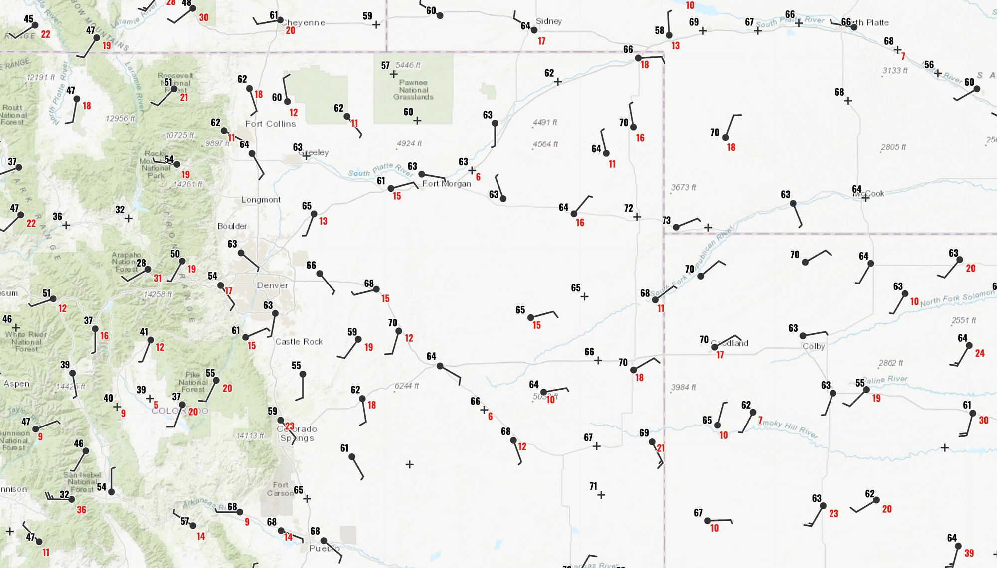
The State of the Atmosphere today is nothing short of splendid. A look at temperatures across Northeast Colorado shortly before noon have most areas sitting comfortably in the low to mid 60s, with many locales set to hit the 70 degree mark again this afternoon.
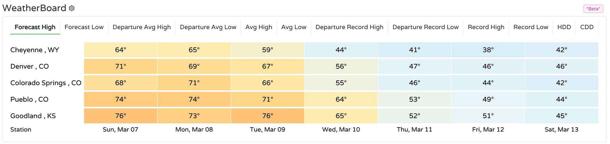
As we outlined for you on Friday, these mild temperatures will stick with us for a couple more days before the pattern begins to change Wednesday. Take a look a temperatures forecast across the region today through Tuesday – wow! Highs near 80 across portions of the plains before cooler and wetter weather returns to the forecast.
The week ahead
There's a lot to get into looking to the coming week, so let's jump in.
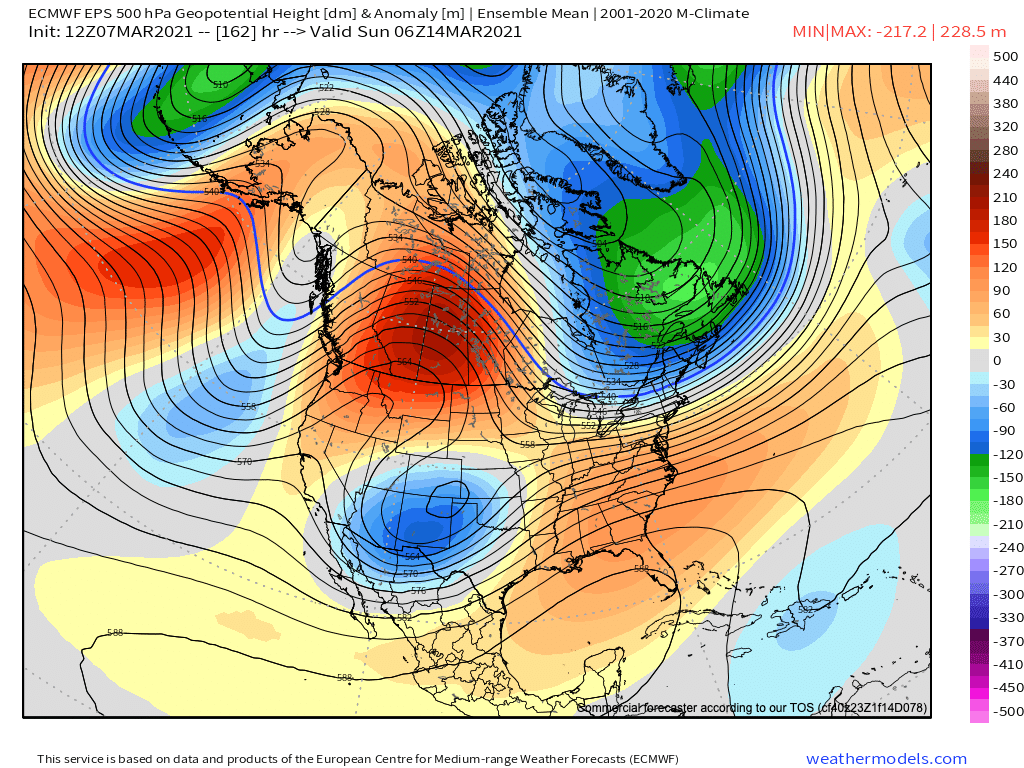
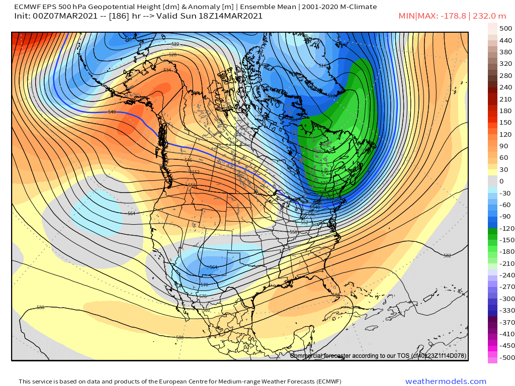
The ridging in place today stays well established through Tuesday before the large low currently off the Pacific Northwest coast begins to make its presence felt around here Tuesday night and Wednesday. Here's the 500mb forecast for this evening from the Euro, thank all that red overhead for the stunning weekend we are enjoying!
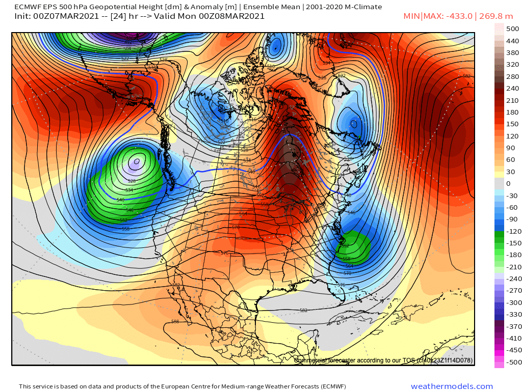
By Tuesday evening we see that trough hasn't moved much, but the core of the ridge is now east of us, and troughing is becoming more impressed in the west. Wednesday will be a transitional day for us, cooler than this weekend and early week, but likely still on the mild side, at least for a portion of the day.
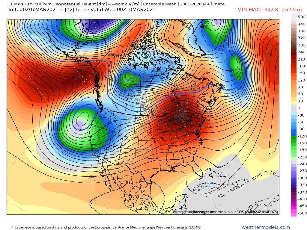
It's what happens to that low between say Thursday and Sunday that we will be watching very closely this week. Guidance tracks the low into the Great Basin, Four Corners, and eventually through the Texas/Oklahoma panhandles – which, depending on speed and strength can be an ideal setup for a bit March snowstorm storm around here.
While models have been producing some eye-popping snowfall totals at times for next weekend across the greater region, a long-awaited classic March storm is by no means a done deal. On the table? Sure.
There's good agreement in the models that the low will move through in some capacity, with the timing looking to be Friday/Saturday for our area... but again, that's plus or minus quite a bit given the uncertainty that remains.
The tendency in the modeling has been to hug a more southerly solution. This has been a theme much of the winter, so not all that inclined to throw it out despite the ongoing La Niña. This would indicate that probabilities for an impactful storm (at this time) are greater across the southern half of the state vs north.
Still, if we look at the GEFS 500mb forecast for next Saturday morning we see a couple things. One, its trend (if there is one) has been a bit quicker and more northerly over the last eight runs. This is probably a good sign if you are living from Denver north to Fort Collins and craving a big March storm.
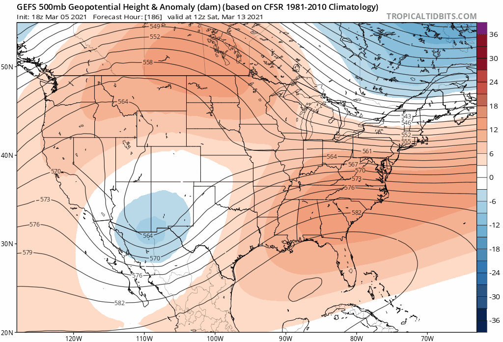
We see a similar trend in the operational GFS as well:
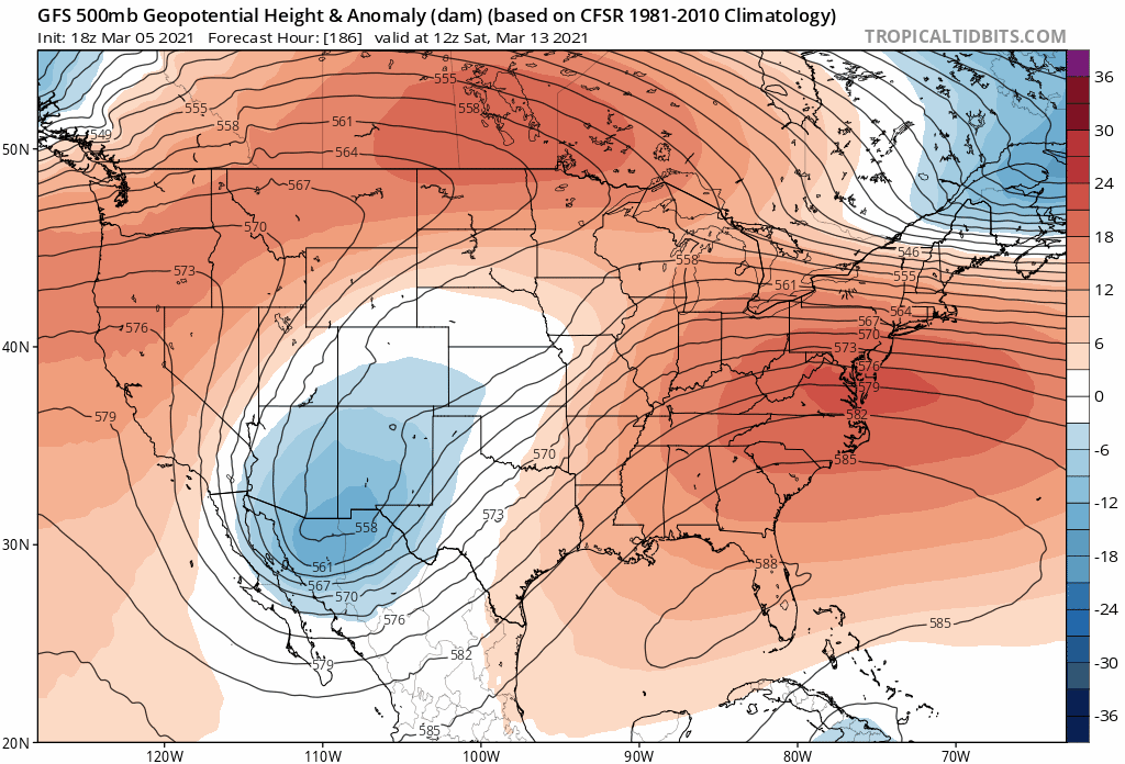
So what about the European? Well, it's more inline with the GEFS this morning than its run last night which perhaps is confidence building. It remains quite a bit slower, not pulling the trough east of the mountains until Saturday night or Sunday morning, but eventually looks quite similar to the what the GEFS has above, and looks better than last night's run for northeast if you're hoping for a storm.

This is quite a bit different of a look from the ensemble mean than its run prior, which never really ejected the low east but showed it shearing apart across the Southwest late next weekend. Whether this is a trend or a one-off fluke is something we'll be watching for.
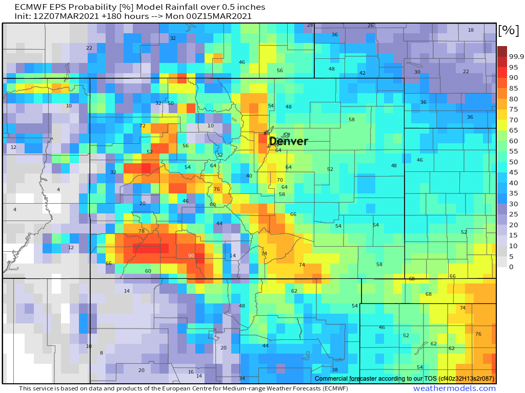
Finally, if we look at precipitation probabilities for 0.5" or more through next Sunday evening we see a pretty good signal for some appreciable moisture across the state showing up in the data. Insiders can see what that means for our snowfall gamblers here.
Caution
Like a good cutoff low, its best to approach these systems slow and steady.
With that, now is when we pile on all the words of caution as you no doubt will be hearing all kinds of chatter about "the big snow" in the coming days if you haven't already this weekend. So we'll just stress it here: there's way too much time and way too much uncertainty with regard to next weekend to be focusing in on one crazy operational model forecast run or another. Cutoff lows are a mess to forecast, the ensembles show some holes in the setup, even if they look a bit better today, and finally we're talking four or five days into the future which ... well, isn't easy to do.
Still, there's enough of a signal there that we thought it made sense to address here. You'll recall we did the same a few weeks back a week or so before Denver picked up its biggest snow of the season.
At the end of the day, this is exactly the time of year that you 1) don't want to ignore the potential from large, lumbering cutoff lows moving through the Four Corners, but 2) also the time of year that models can go bananas with snowfall output and it prove all for naught. So, let's watch this one closely... and we'll be passing along updates as needed through the week in case it turns into something!
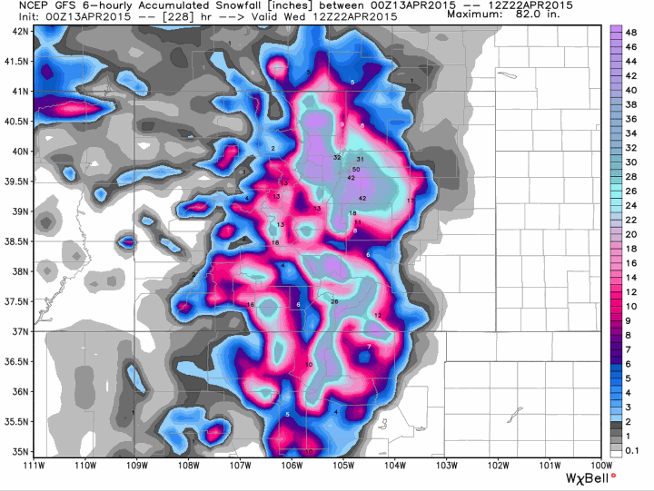
Who remembers this gem from the GFS a few years back? From forecasting near 50" of snow for Denver to just 0.5" in just 6 hours. The system eventually ended up delivering 4.1" of snow, don't fall for the trap!