Banded snow event means boom potential on the table with Friday's snow chance

Looking over morning data for today's snow event looks interesting enough that we thought we'd offer a quick update on the forecast as things get under way across Northern Colorado this morning, and eventually across the greater Denver metro area and points south.
While nothing has changed all that dramatically from our update last night, guidance has been trending a bit wetter overall, and confidence in the idea that we'll see some bands of heavier snow develop today is greater. We are already seeing a band of snow extending from Fort Collins southeast across the plains. This energy will gradually work its way south into the Denver area through midday and early afternoon.
Despite greater confidence in the idea that someone is likely to see a period of heavy snow this afternoon and with that several inches of accumulation, there are a lot of small-scale ingredients at play in today's setup that means confidence in exactly where these heavier bands will set up is low to medium.
One ingredient at play is a northerly jet overhead which will place Northeast Colorado under the left exit region of that jet this afternoon and will provide a bit of extra lift to accompany the upslope that will be in place.
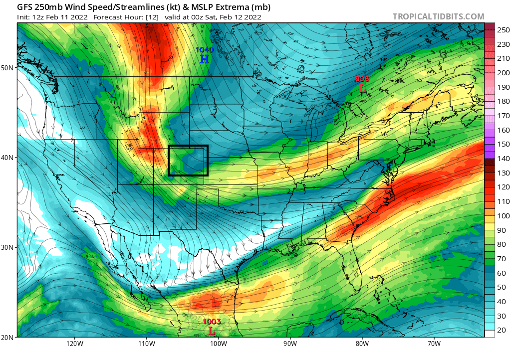
We know that when the jet gets involved, we can see some impressive albeit often narrow bands of heavy snow develop in and along the Front Range.
If we look at the latest HRRR hourly snowfall forecast through about midnight, we see these snow bands develop across Northern Colorado this morning, then gradually intensifying and moving south through the evening and overnight hours. These bands will extend from the northwest to southeast across the foothills and adjacent plains, with rates of 2"+ an hour possible (indicated in the darker purple colors you see below):
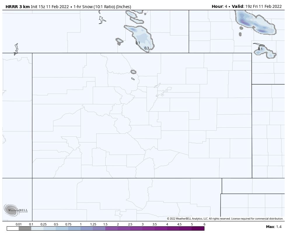
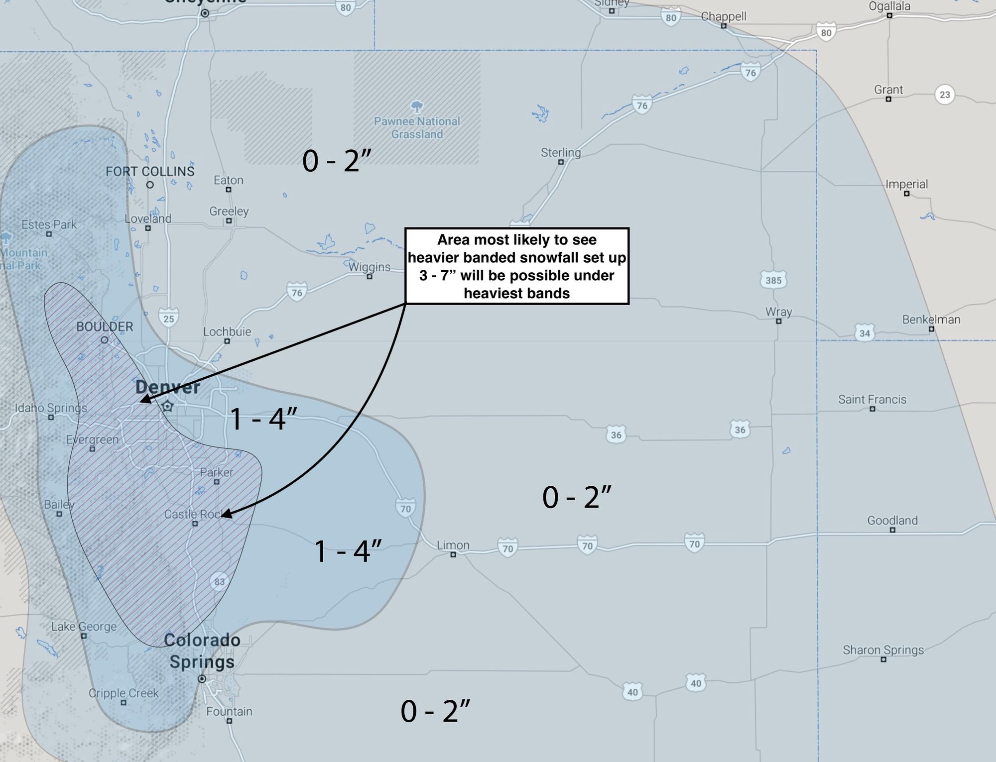
This particular model puts 3 - 4" over Denver, with upwards of 6"+ for some of the immediate foothills west of Denver in Boulder and Jefferson counties:

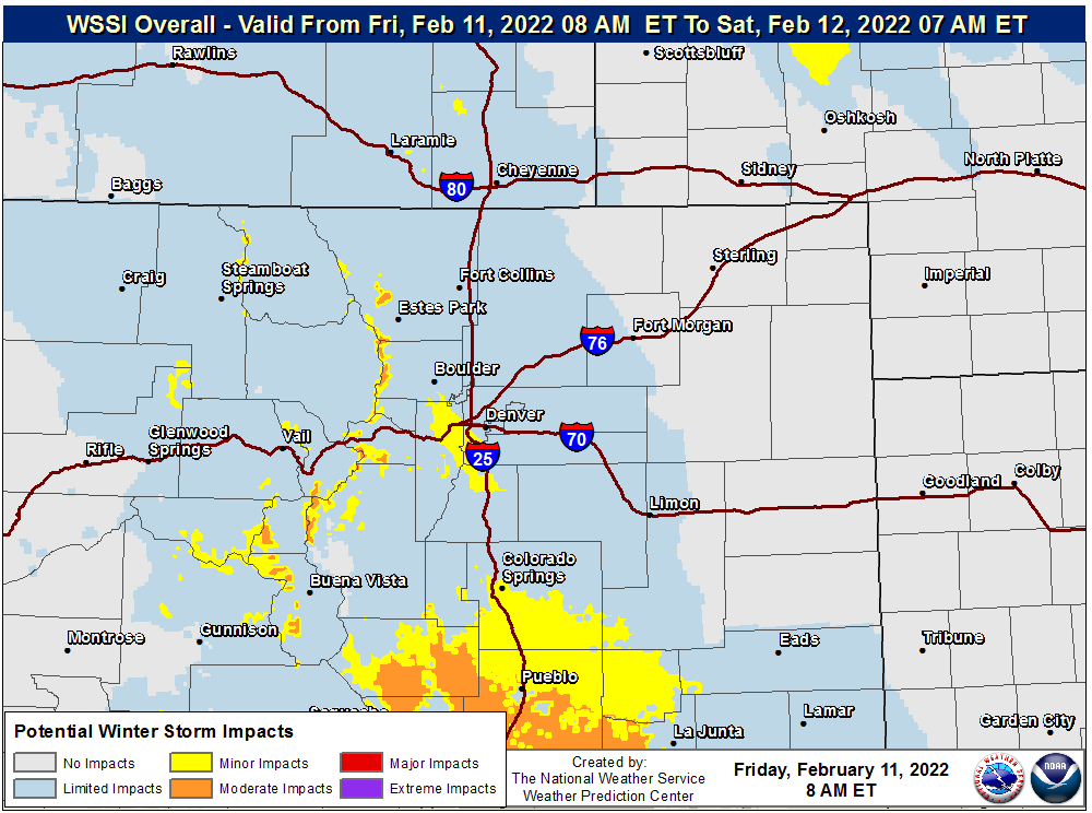
Needless to say, if this occurs, this afternoon's rush will be a slow-go, and those leaving for the mountains for the weekend will have to traverse a tough climb out of the city similar to what we saw a few weeks back. The WSSI hazards graphic shows this potential on Denver's west/southwest side, and perhaps is under doing impact risks here should the heavier banded snow develop.
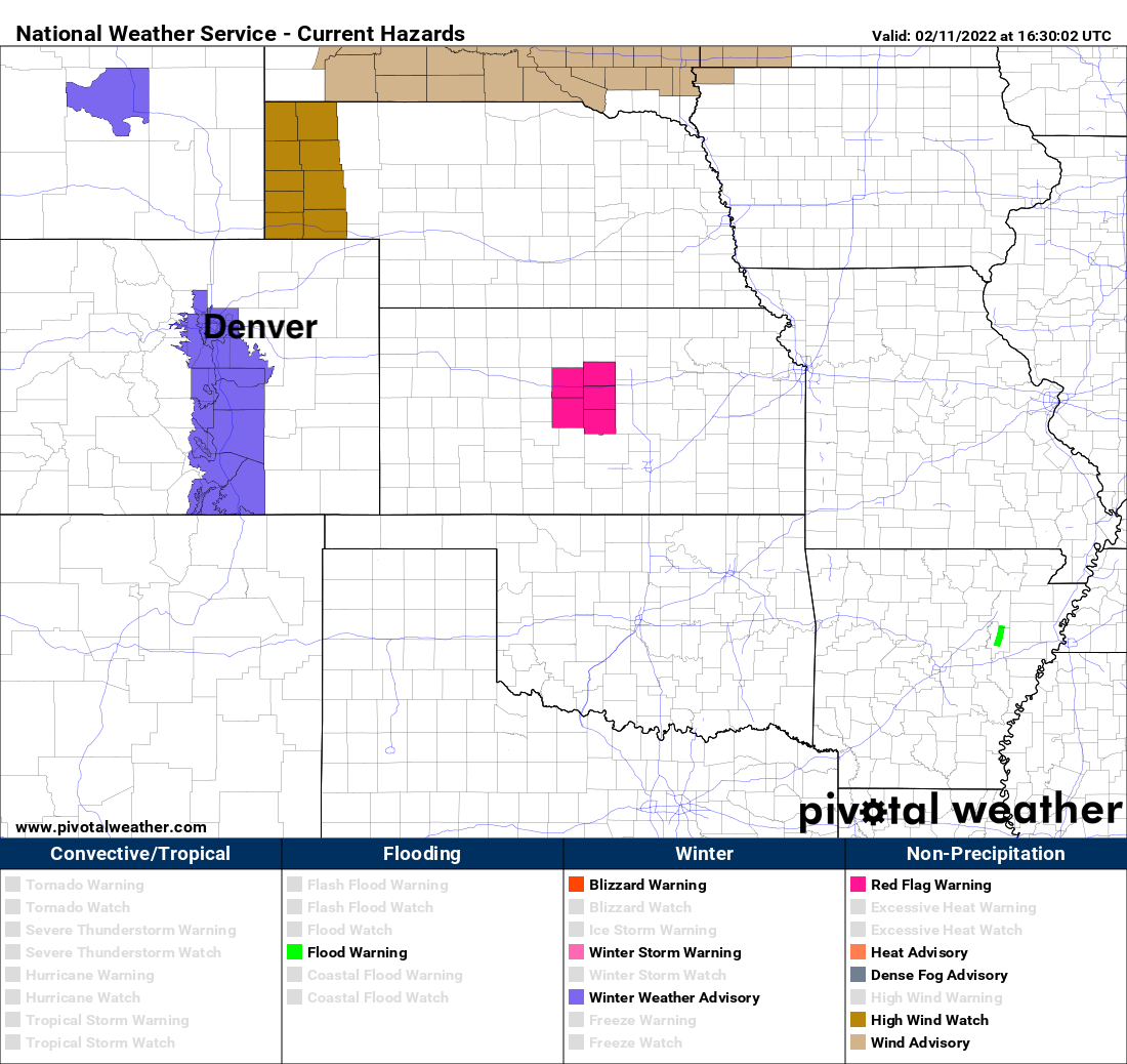
With the greater confidence in snow later today, we see the NWS has issued a Winter Weather Advisory for the Denver/Boulder area and points south along the I-25 corridor. The Advisory goes into effect at 2pm, and expires at 11pm, and is denoted in purple below:
For our forecast, we'll bump up totals a bit for the Denver area, with 1 - 4" across the metro and Palmer vs the T - 3" we had last night. We've mostly left the hashed area alone, where we still think this area will see the greatest chance for those heavier bands to materialize, but nothing is certain!
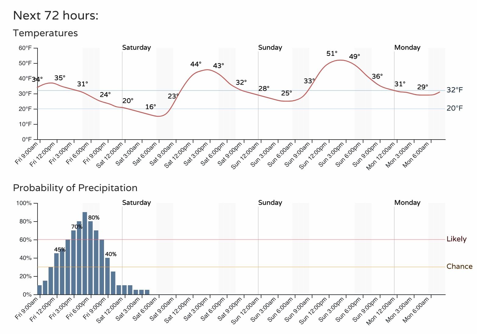
After today's burst of snow the system quickly exits. Saturday will see highs back in the 40s for Denver, and 50s on the way for Sunday.