Colorado weather: Mountain snow, first flakes at lower elevations(?), and first hard freeze for many on the way

A little more than 24 hours removed from our last update on the incoming system and things don't look all that different in today's light. Changes are still set to arrive for the second half of the week, mountain snow is still expected, and for lower elevations many areas will likely see their first sub-freezing temperatures of the season by week's end – as well as the potential for the season's first flakes.
First, and most importantly, add your entry to this year's First Measurable Snowfall Prediction contest, today is the last day to do so:
Yesterday we discussed the fact the pattern favored a northerly track across the region. A northerly track means the greatest impacts would be favored across the Northern Rockies, Wyoming, South Dakota, and Nebraska, with lesser impacts across the Denver metro area and points south.
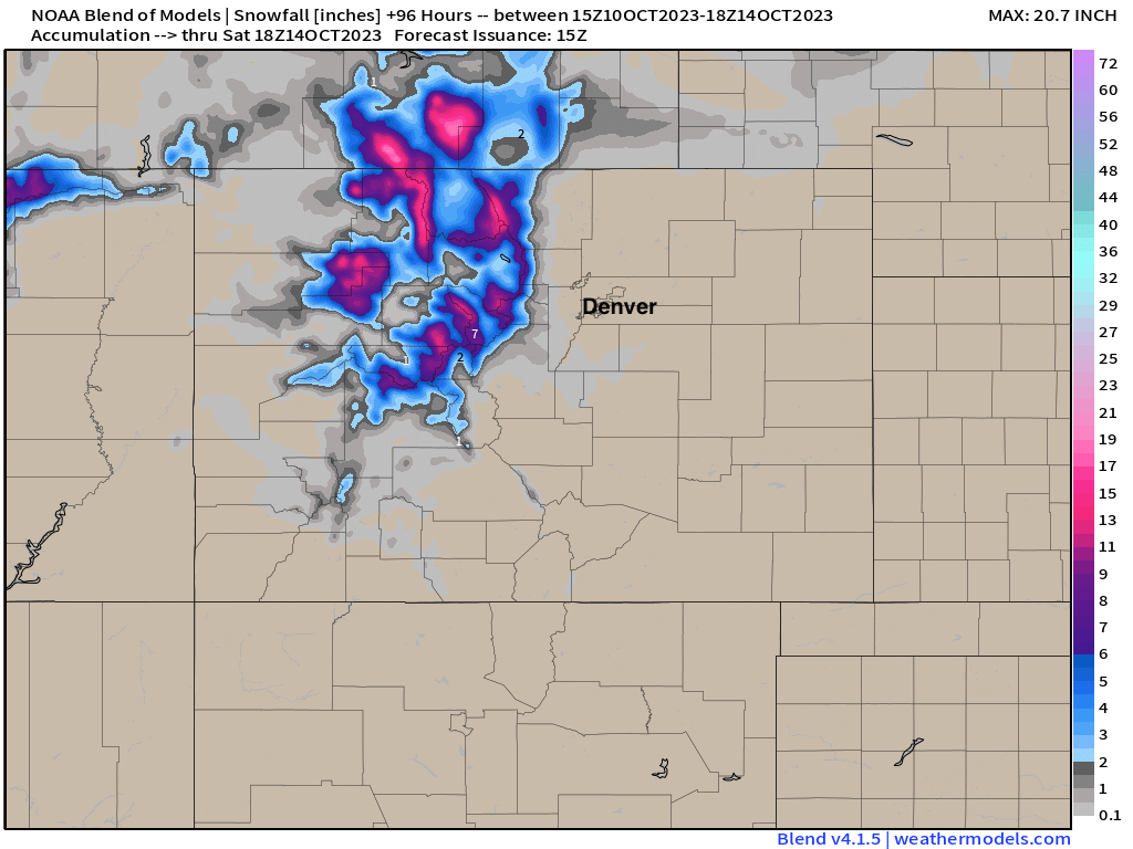
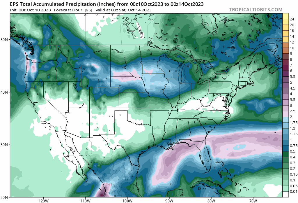
Guidance since yesterday hasn't changed this idea much, and if anything has reinforced the idea that the bulk of the hazardous weather will move to the north of many of us. You can see in the ensemble mean precipitation forecast a jump north with with the heaviest precipitation totals across Northeast Colorado between yesterday and today's early morning run:
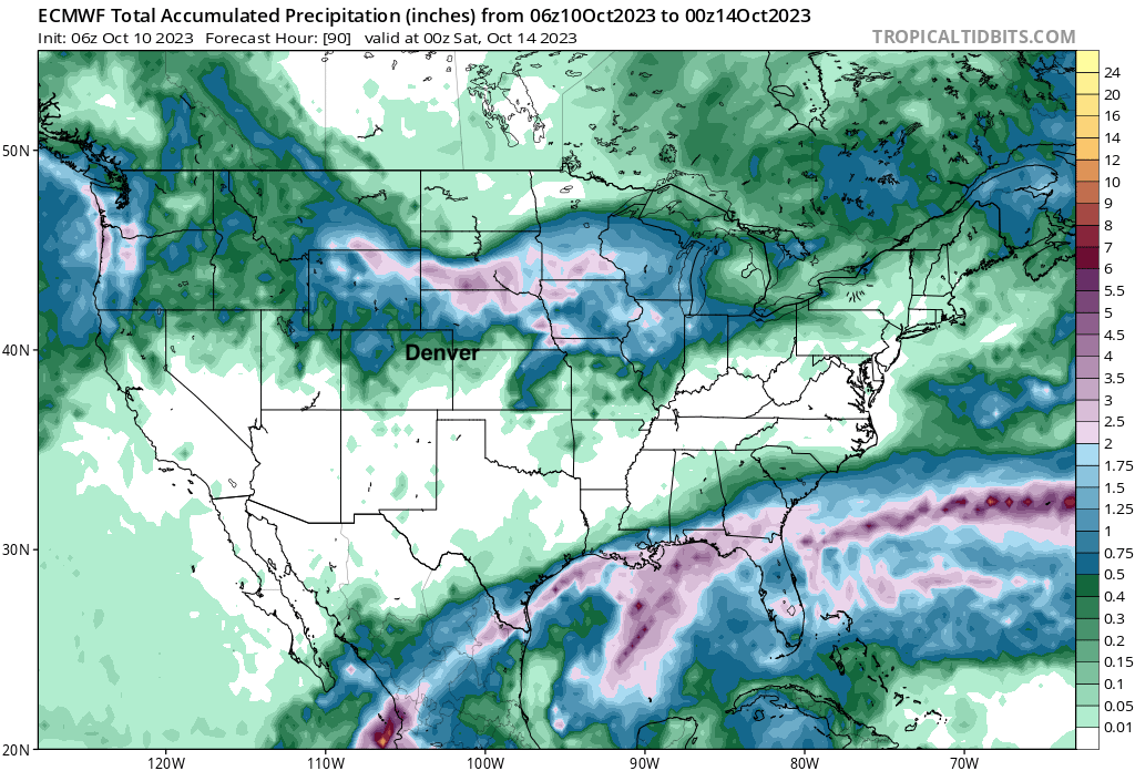
The operational is very far north:
The national blend of models now only has about 0.2" of liquid for the Denver area from this system, with upwards of 1" north of the Colorado state line:
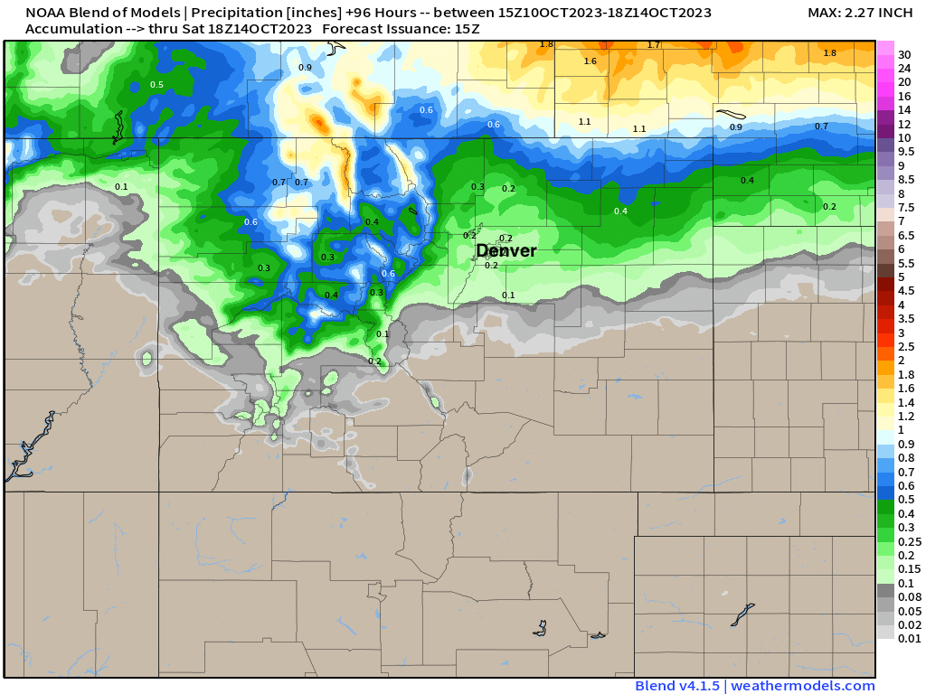
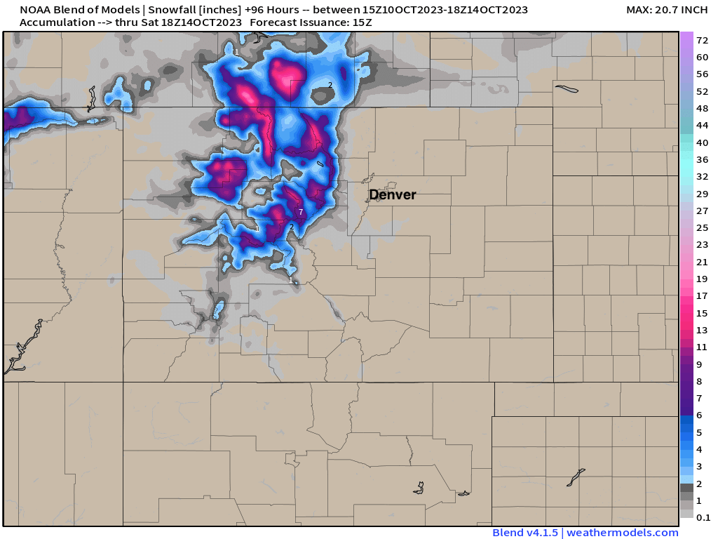
Some good moisture also present for the north-central mountains of Colorado, and you guessed it... that means snow! The blend has some appreciable snow for the higher peaks, but only a dusting or so across the Palmer Divide and Cheyenne Ridge:
So, not super exciting if you're hoping for snow in Denver, or really rain for that matter. Still some time for things to change... so keep an eye on the forecast, but for now it looks like this thing wants to scoot north.
Timing and temperatures
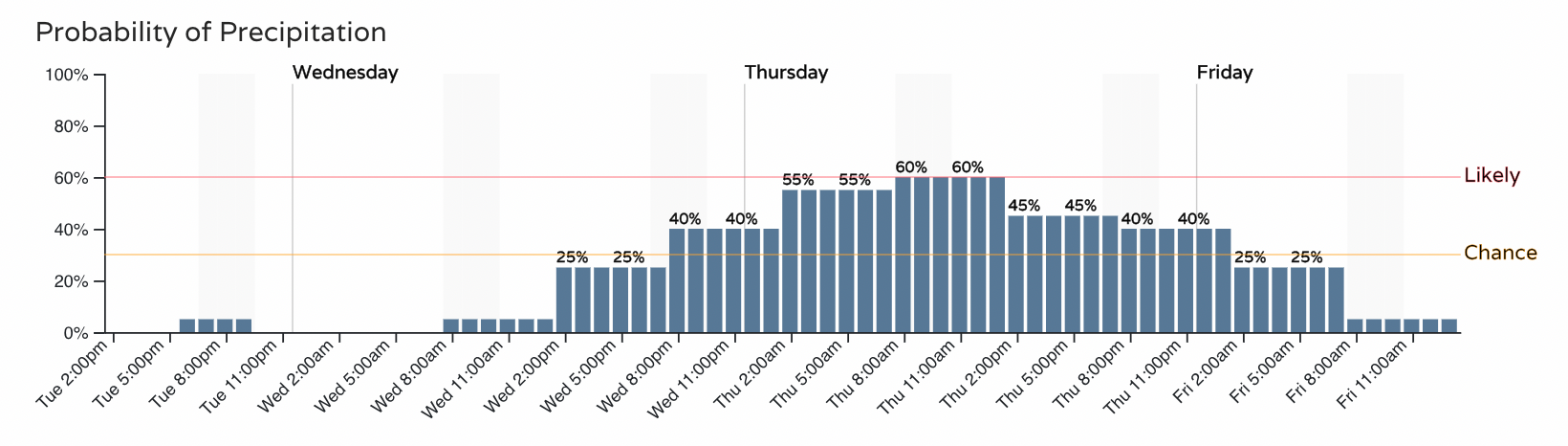
Another nice day or two before things change. Even with the heaviest precipitation likely to stay north, Wednesday PM through Thursday will feature the chance of rain, mixed precipitation, and even some snow depending on your location and elevation. For Denver the chance for precipitation increases to the "chance" category Wednesday evening and carries through Thursday evening:
Also as we discussed yesterday, we don't have a lot of cold air to work with. IF we can keep precipitation going into Thursday evening that's when we're most likely to manage some flakes at lower elevations. We'll see.
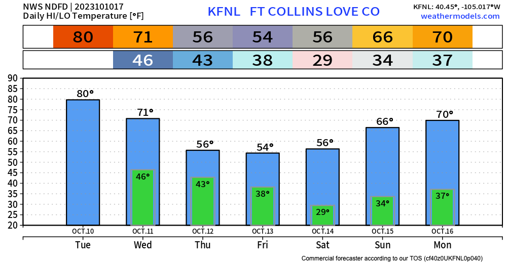
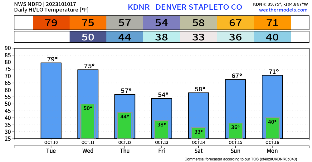
Highs will be near 80°F today, in the low to mid 70s Wednesday, then into the 50s for the remainder of the week. The coldest night of the week looks to come Friday night into Saturday (after the storm has departed east) where lows could dip to or below freezing.
For Fort Collins latest guidance supports a low of 29°F on Saturday morning:
For Denver near freezing:
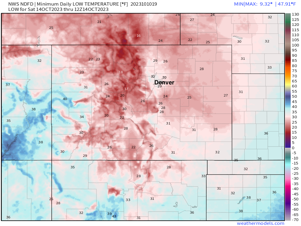
And a look statewide shows widespread 20s and 30s Saturday morning, with even some teens across the higher peaks. Brr!
With the snow season heating up, don't get left out in the cold this winter! Stay one step ahead of the changing weather by subscribing to our email list today!