Hundreds of homes lost as devastating fires continue; snow and cold arrive tomorrow and not a moment too soon

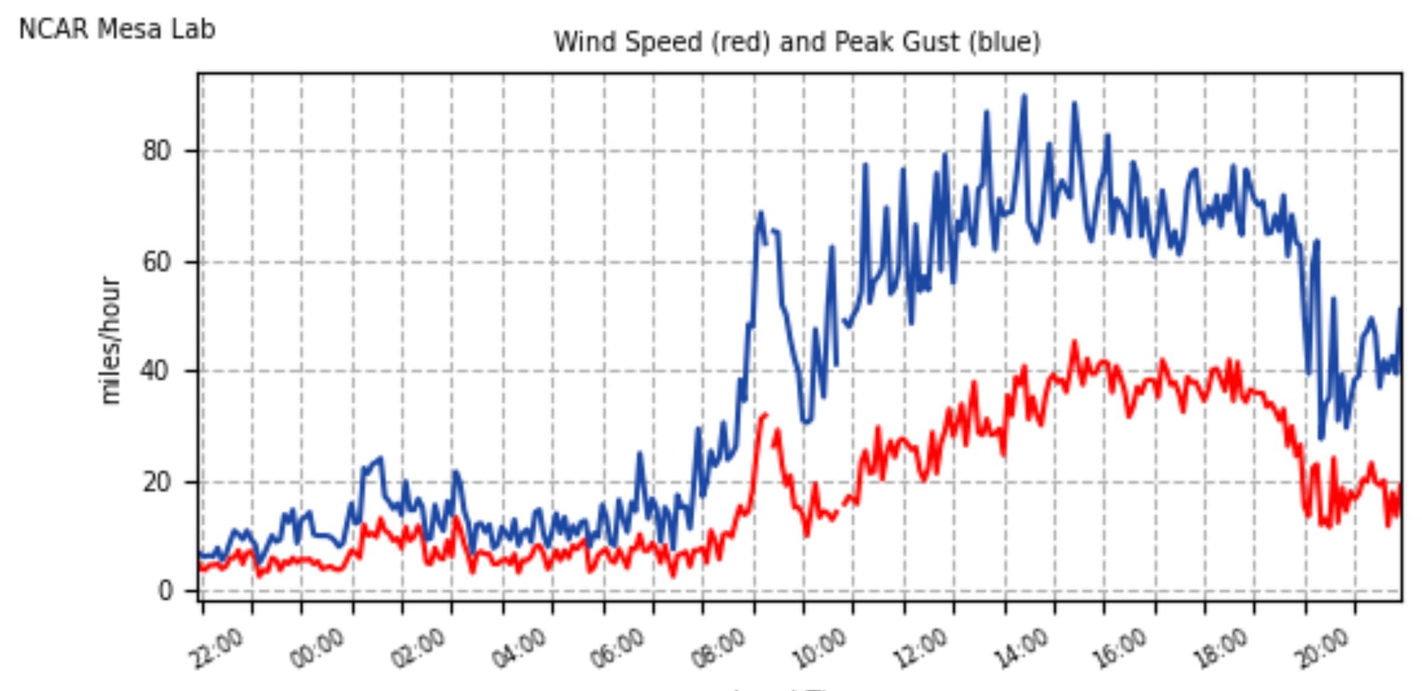
All High Wind Warnings have finally been dropped after a day featuring hour after hour of relentless wind and gusts to 100 mph along the Front Range. Still, gusty winds continue along the Front Range and urban corridor, and will do so through the middle of the night before dying down toward morning.
A look at wind reports from NCAR shows gusts have dropped off from 90 mph in the 40 mph range, with sustained winds subsiding as well. We are headed in the right direction, but several more difficult hours of fire-fighting ahead before meaningful help arrives from the weather.
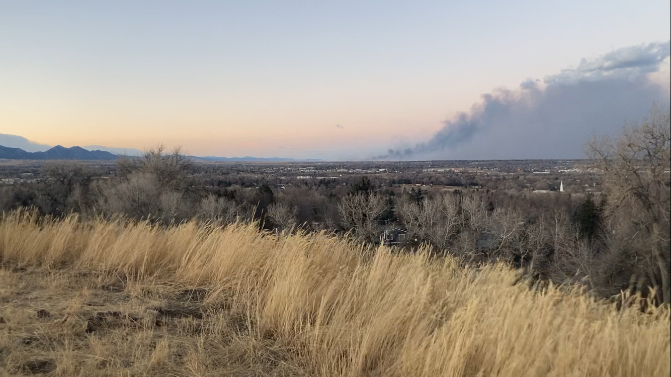
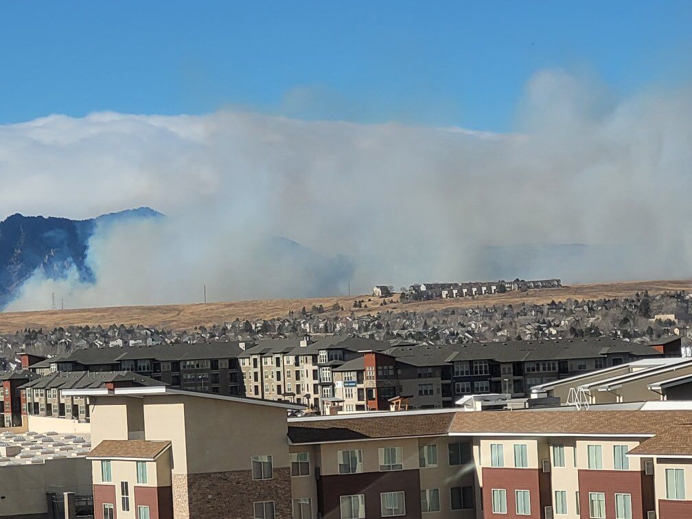
Latest reports indicate at least 600 homes have been lost in today's fires, with perhaps much more than that by some estimates. Today's fires will become the state's most destructive on record, surpassing the Black Forest Fire in 2013 (509 homes lost). We won't have a clear picture on the extent of the properties lost and damages for some time as the scene across northwest Denver tonight remains chaotic and quickly changing. Just an absolutely stunning day.
From our photog @dave_wille near the Flatirons. These fires continue to take out entire neighborhoods. @CBSDenver #MarshallFire pic.twitter.com/UMViz2reI6
— Ryan Greene 📷 (@RyanCBS4) December 31, 2021
Here is the latest evacuation and pre-evacuation map from the Boulder OEM, which will be updating through the night:
We will touch on the latest snowfall outlook here tonight, but in case you missed it some other relevant articles to today's fires and tomorrows storm below.
The backdrop to today's event, and extremely dry second half of 2021:
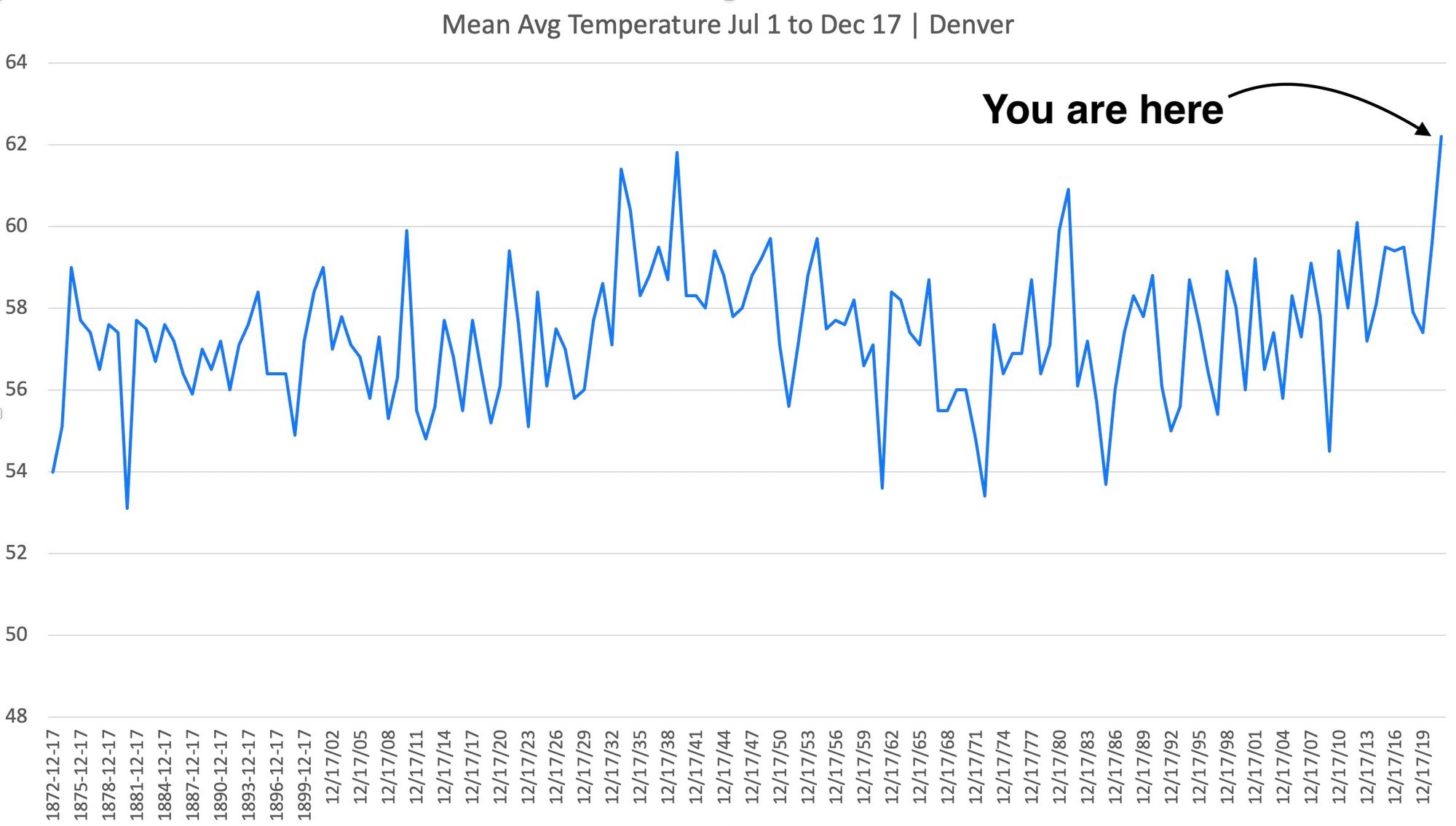
I don't enjoy updating these plots and seeing the current year on its own in the upper left. From June 1-Dec 29, the Front Range has been the warmest on record (by far), and among the driest. These conditions set the stage for today's historic, tragic, devastating fires. #cowx 1/ pic.twitter.com/e5MTryF6t3
— Russ Schumacher (@russ_schumacher) December 31, 2021
Latest updates from the fires:
And latest forecast discussion from earlier today:
Bitter cold and snow
Bitter cold and snow to follow today's extreme wind and fire event. The latest hourly timeline shows precipitation chances increasing by late morning Friday, with the greatest potential for snow along the Front Range coming Friday afternoon and Friday night.
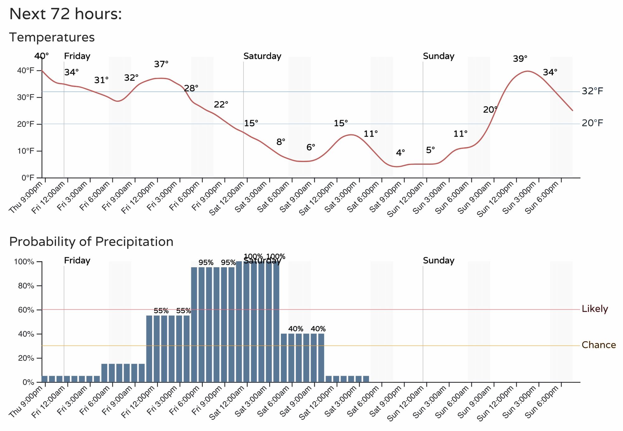
We will see how things look in the morning, but for now see now need to change much from our forecast earlier today.
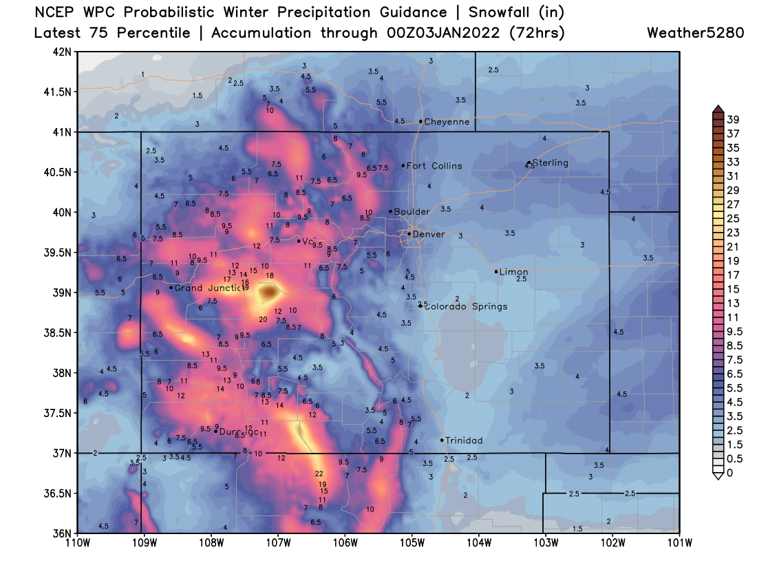
- Fort Collins: 2 - 6"
- Boulder: 5 - 10"
- Evergreen 5 - 10"
- Denver: 2 - 6"
- Castle Rock: 2 - 6"
- Colorado Springs: 1 - 4"
We all anxiously await tomorrow's weather change. Tonight we hold everyone impacted by today's fires in our thoughts, and hope fire fighting efforts can make quick progress as the winds subside tonight.